Tuesday, February 24, 2015

Deep-Sea Hydrothermal Vents


Deep-sea hydrothermal vents are found in geologically active areas of the ocean floor.  These vents are formed when the ocean water gets into the Earth’s crust, and magma heats the water.  When the water is boiling it goes back up to the surface all the while dissolving minerals and other types of rock.  At the ocean floor again, the water is now extremely dark.  Eventually, the rim of the vent will begin to look like a chimney.  The water that is expelled from these deep-sea hydrothermal vents is greater than 360 degrees Fahrenheit.  Organisms that live near the vents obtain their food from the vents through chemosynthesis.  Riftia, or giant tubeworms, are abundant in this environment.  These giant tubeworms are food for small shrimps and crabs.  Clams also live here.


Mineral Identification


1) Pyrite
Also called Fools Gold, pyrite is composed of iron sulfide.  It is an opaque mineral with a metallic luster.  It is a brittle mineral that is formed in all types of environments.


2) Gypsum
Gypsum is composed of hydrous calcium sulfate.  Gypsum is usually found with no pieces broken off of it.  This mineral is known for its flexibility, and it can also be transparent or opaque.  Gypsum also has a vitreous to pearly luster. A vitreous luster is reflective like glass.

Maps & Topography


1) Chloropleth map

This kind of map will be used when your data  has a unit(s) like countries or counties, standardized to show rates or ratios, and a continuous statistical surface. 


2) Isarithmic map
This kind of map will be used for continuous data, such as elevation and precipitation.
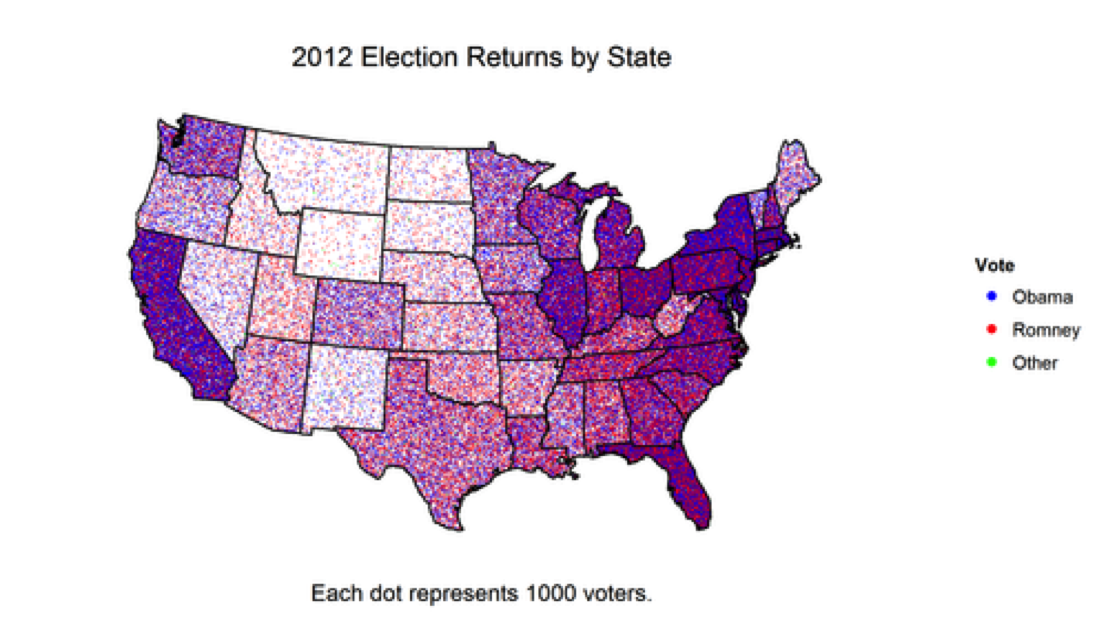


3) Dot Density map

This kind of map will be used to show density differences across a landscape.


4) Proportional Symbol map

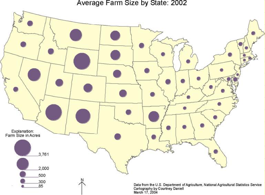
This type of map scales the size of symbols proportionally to the data value found at that location. In short, the larger the symbol, more of whatever is being studied exists at that location.